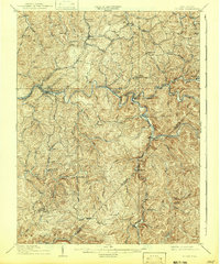
1910 Map of Sutton
USGS Topo · Published 1942About this map
The Sutton river valley serves as the industrial and logistical heart of this Central West Virginia landscape at the onset of the 20th century. The Elk River carves a winding path through the hills, its course paralleled and crossed by a burgeoning network of transit, including the Coal and Coke Ry and the Baltimore and Ohio RR. These rails connect riverside settlements and remote post offices like Gillespie Hyer PO and Bakers Run Levi PO to the broader regional economy.
Find a feature on this map
66 named features on this map. Tap any name to fly to it.
Don’t see what you’re looking for? This feature index may not catch every label — zoom into the map to look around manually.
Map Details
Editions of this 1910 Sutton Map
3 editions found

Other maps of this area

1889 · Nicholas
USGS Topo · 1:125,000

1891 · Nicholas
USGS Topo · 1:125,000

1891 · Huntersville
USGS Topo · 1:125,000

1893 · Buckhannon
USGS Topo · 1:125,000

1893 · Sutton
USGS Topo · 1:125,000

1894 · Huntersville
USGS Topo · 1:125,000

1896 · Buckhannon
USGS Topo · 1:125,000

1897 · Buckhannon
USGS Topo · 1:125,000

1901 · Nicholas
USGS Topo · 1:125,000

1906 · Glenville
USGS Topo · 1:62,500