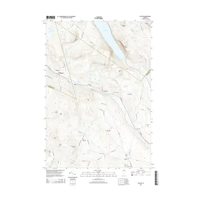
2015 Map of Sutton
USGS Topo · Published 2015About this map
Lake Willoughby dominates the northern landscape of this region, carved between the dramatic heights of Mt Pisgah and Mt Hor. The terrain is defined by a series of north-south ridges and mountain peaks, including Wheeler Mtn and Hedgehog Mtn, which frame the deep glacial waters. Settlements such as Sutton, Willoughby, and Perry are scattered throughout the valleys, connected by winding roads like Lynburke Rd and the Sutton River corridor.
Find a feature on this map
93 named features on this map. Tap any name to fly to it.
Don’t see what you’re looking for? This feature index may not catch every label — zoom into the map to look around manually.
Map Details
Editions of this 2015 Sutton Map
This is the sole edition of this map. No revisions or reprints were ever made.
Other maps of this area

1919 · Lake Memphremagog
USGS Topo · 1:62,500

1920 · Derby
USGS Topo · 1:62,500

1923 · Lake Memphremagog
USGS Topo · 1:48,000

1924 · Island Pond
USGS Topo · 1:48,000

1925 · Memphremagog
USGS Topo · 1:62,500

1926 · Island Pond
USGS Topo · 1:62,500

1935 · Lyndonville
USGS Topo · 1:48,000

1939 · Lyndonville
USGS Topo · 1:62,500

1950 · Lake Champlain
USGS Topo · 1:250,000

1950 · Lewiston
USGS Topo · 1:250,000