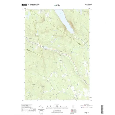
2018 Map of Sutton
USGS Topo · Published 2018About this map
Sutton and the surrounding highlands of the Vermont Northeast Kingdom are defined by the dramatic notch carved through the granite peaks of Mt Pisgah and Mt Hor. The waters of Lake Willoughby dominate the northern landscape, while a complex drainage system feeds the Sutton River and the W Br Passumpsic River to the south. Historically significant landmarks include the Union House near King James Cem, providing a window into the 19th-century settlement patterns of these upland communities.
Find a feature on this map
91 named features on this map. Tap any name to fly to it.
Don’t see what you’re looking for? This feature index may not catch every label — zoom into the map to look around manually.
Map Details
Editions of this 2018 Sutton Map
This is the sole edition of this map. No revisions or reprints were ever made.
Other maps of this area

1919 · Lake Memphremagog
USGS Topo · 1:62,500

1920 · Derby
USGS Topo · 1:62,500

1923 · Lake Memphremagog
USGS Topo · 1:48,000

1924 · Island Pond
USGS Topo · 1:48,000

1925 · Memphremagog
USGS Topo · 1:62,500

1926 · Island Pond
USGS Topo · 1:62,500

1935 · Lyndonville
USGS Topo · 1:48,000

1939 · Lyndonville
USGS Topo · 1:62,500

1950 · Lake Champlain
USGS Topo · 1:250,000

1950 · Lewiston
USGS Topo · 1:250,000