1963 Map of Sutwik Island A-3
USGS Topo · Published 1968About this map
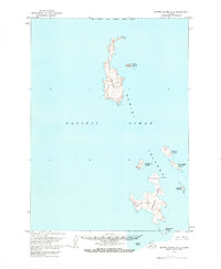
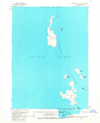
The Semidi Islands rise from the Pacific Ocean in this mid-century topographic record, encompassing the entirety of the Semidi National Wildlife Refuge. This remote archipelago is dominated by the large landmasses of Aghiyuk Island to the north and Chowiet Island to the south. The survey reveals a landscape shaped by marine activity, noting specific landmarks such as Aghik Island, Anowik Island, and Kateekuk Island. While devoid of permanent human settlements, the map documents triangulation points and named peaks like Aghiyuk and Chowiet, alongside smaller outcrops including Kiliktagik Island and Suklik Island. These islands, mapped using 1957 aerial photography, represent a preserved wilderness state within the Gulf of Alaska, where the only named features are the landforms themselves and the wildlife colonies implied by the refuge status.
Find a feature on this map
17 named features on this map. Tap any name to fly to it.
Don’t see what you’re looking for? This feature index may not catch every label — zoom into the map to look around manually.
Map Details
Editions of this 1963 Sutwik Island A-3 Map
2 editions found