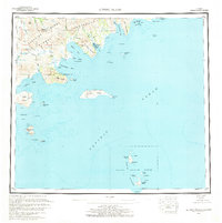
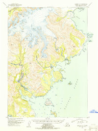
1963 Map of Sutwik Island
USGS Topo · Published 1968About this map
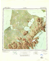
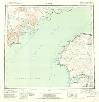
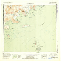
The Alaska Peninsula coastline and the surrounding Pacific Ocean waters dominate this mid-century topographical study. The landscape is defined by the sharp peaks of the Aleutian Range, including Elephant Mountain and Jaw Mtn, which feed a network of coastal drainages such as the Aniakchak River and Cinder River. While settlement is nearly nonexistent, represented only by a isolated Cabin and a Village site near Aniakchak Bay, the map provides exceptional detail of the offshore environment. The southern portion of the map is dedicated to the remote outcroppings of the Semidi National Wildlife Refuge, featuring Chowiet Island, Aghiyuk Island, and several smaller islets. Navigational markers like Foggy Cape Light on Sutwik Island and landmarks such as the Aiugnak Columns highlight the maritime importance of this stretch of the Alaskan coast near Chignik Bay.
Find a feature on this map
83 named features on this map. Tap any name to fly to it.
Don’t see what you’re looking for? This feature index may not catch every label — zoom into the map to look around manually.
Map Details
Editions of this 1963 Sutwik Island Map
2 editions found

Other maps of this area
1943 · Ugashik
USGS Topo · 1:250,000

1948 · Ugashik
USGS Topo · 1:250,000

1949 · Ugashik
USGS Topo · 1:250,000

1951 · Bristol Bay
USGS Topo · 1:250,000

1951 · Trinity Islands
USGS Topo · 1:250,000
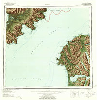
1951 · Karluk
USGS Topo · 1:250,000

1951 · Stepovak Bay
USGS Topo · 1:250,000
1951 · Sutwik Island
USGS Topo · 1:250,000
1951 · Ugashik A-2
USGS Topo · 1:63,360
1952 · Karluk
USGS Topo · 1:250,000