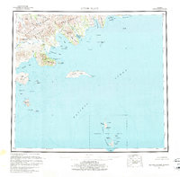
1963 Map of Sutwik Island
USGS Topo · Published 1976About this map
The Aleutian Range dominates the northwestern horizon of this maritime survey, where glacial runoff feeds into the Aniakchak River and eventually the Aniakchak Lagoon. This stretch of the Alaska Peninsula is characterized by a complex coastline of deep-water inlets and rugged headlands, including Amber Bay and Kujulik Bay. The map highlights the isolation of the region in the early 1960s, with only a solitary Cabin noted near the shore of Aniakchak Bay.
Find a feature on this map
64 named features on this map. Tap any name to fly to it.
Don’t see what you’re looking for? This feature index may not catch every label — zoom into the map to look around manually.
Map Details
Editions of this 1963 Sutwik Island Map
2 editions found

Other maps of this area

1943 · Ugashik
USGS Topo · 1:250,000

1948 · Ugashik
USGS Topo · 1:250,000

1949 · Ugashik
USGS Topo · 1:250,000

1951 · Bristol Bay
USGS Topo · 1:250,000

1951 · Trinity Islands
USGS Topo · 1:250,000

1951 · Karluk
USGS Topo · 1:250,000

1951 · Stepovak Bay
USGS Topo · 1:250,000

1951 · Sutwik Island
USGS Topo · 1:250,000

1951 · Ugashik A-2
USGS Topo · 1:63,360

1952 · Karluk
USGS Topo · 1:250,000