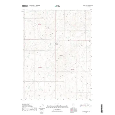
2018 Map of Swales Mountain
USGS Topo · Published 2018About this map
Swales Mountain and the southern reach of the Independence Mountains define this high-altitude landscape in Elko County. The terrain is a complex network of ridgelines and drainage basins, characterized by a series of springs that have likely served as vital water sources in this arid environment for generations. Key water points such as Mud Springs, Yellow Spring, Louse Spring, and Mine Spring are scattered across the slopes, feeding into local drainages like Cottonwood Creek and Donna Creek. The map reveals a land structured by township and range lines, including t35n r52e and t36n r53e, illustrating the systematic division of the Nevada interior. From the heights of Fish Creek Mountain to the depths of Dry Gulch, the topography highlights the isolation and specialized land use common in the Great Basin region.
Find a feature on this map
21 named features on this map. Tap any name to fly to it.
Don’t see what you’re looking for? This feature index may not catch every label — zoom into the map to look around manually.
Map Details
Editions of this 2018 Swales Mountain Map
This is the sole edition of this map. No revisions or reprints were ever made.
Other maps of this area

1955 · McDermitt
USGS Topo · 1:250,000

1955 · Wells
USGS Topo · 1:250,000

1955 · Winnemucca
USGS Topo · 1:250,000

1955 · Elko
USGS Topo · 1:250,000

1958 · Winnemucca
USGS Topo · 1:250,000

1958 · Wells
USGS Topo · 1:250,000

1958 · Elko
USGS Topo · 1:250,000

1958 · Singletree Creek
USGS Topo · 1:24,000

1958 · Hunter
USGS Topo · 1:24,000

1958 · Blue Basin
USGS Topo · 1:24,000