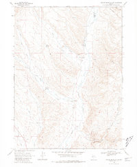
1968 Map of Swales Mountain NW
USGS Topo · Published 1981About this map
Coyote Ranch sits at the convergence of mountain drainages in this mid-century survey of the high desert terrain along the Eureka Co Elko Co line. The landscape is defined by an intricate network of seasonal watercourses, including Maggie Creek, Little Jack Creek, and Coyote Creek, which draw from higher elevations toward the valley floors. Evidence of land use and resource management appears in the form of scattered prospects, several gravel pits, and the Rebholtz Well No 1. The map reveals a frontier still characterized by ranching and light extraction, where named water sources like Chicken Springs were vital landmarks for navigation and survival in a region where an Indefinite Boundary still marked the transition between county jurisdictions.
Find a feature on this map
18 named features on this map. Tap any name to fly to it.
Don’t see what you’re looking for? This feature index may not catch every label — zoom into the map to look around manually.
Map Details
Editions of this 1968 Swales Mountain NW Map
2 editions found

Other maps of this area

1955 · McDermitt
USGS Topo · 1:250,000

1955 · Winnemucca
USGS Topo · 1:250,000

1958 · Winnemucca
USGS Topo · 1:250,000

1958 · Blue Basin
USGS Topo · 1:24,000

1958 · Huntsman Ranch
USGS Topo · 1:24,000
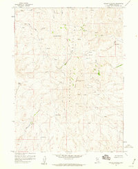
1958 · Swales Mountain
USGS Topo · 1:24,000

1959 · McDermitt
USGS Topo · 1:250,000

1962 · Winnemucca
USGS Topo · 1:250,000

1968 · Rodeo Creek NE
USGS Topo · 1:24,000

1968 · Welches Canyon
USGS Topo · 1:24,000