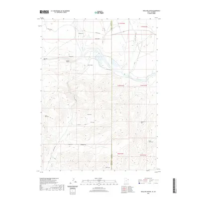
2020 Map of Swallow Canyon
USGS Topo · Published 2020About this map
The Green River carves a deep path through the landscape of the borderlands between Utah and Colorado, defining the topography of Swallow Canyon and the valley of Browns Park. This region is characterized by a network of drainage systems including Willow Cr and Beaver Cr, which feed into the main river channel from the surrounding Uinta Mountains. The map reveals a remote terrain marked by numerous named draws such as George Draw, Yellow Jacket Draw, and Chokecherry Draw, each cutting through the high elevations.
Find a feature on this map
34 named features on this map. Tap any name to fly to it.
Don’t see what you’re looking for? This feature index may not catch every label — zoom into the map to look around manually.
Map Details
Editions of this 2020 Swallow Canyon Map
This is the sole edition of this map. No revisions or reprints were ever made.
Other maps of this area

1885 · Ashley
USGS Topo · 1:250,000

1952 · Warren Draw
USGS Topo · 1:24,000

1952 · Willow Creek Butte
USGS Topo · 1:24,000

1952 · Swallow Canyon
USGS Topo · 1:24,000

1952 · Clay Basin
USGS Topo · 1:24,000

1954 · Lodore School
USGS Topo · 1:24,000

1954 · Canyon of Lodore North
USGS Topo · 1:24,000

1954 · Vernal
USGS Topo · 1:250,000

1958 · Vernal
USGS Topo · 1:250,000

1960 · Vernal
USGS Topo · 1:250,000