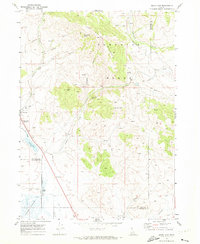
1969 Map of Swan Lake
USGS Topo · Published 1973About this map
Swanlake and the nearby rail siding of Swan Lake serve as the primary focal points in this high-desert landscape along the border of Bannock and Franklin Counties. The settlement pattern is defined by the Union Pacific Railroad and its alignment with the low-lying terrain of the Oxford Slough. To the east, the topography rises sharply into the Portneuf Range, creating a dramatic physical boundary between the agricultural valley and the upland wilderness. The presence of numerous springs—such as Dry Hollow Spring and Hutchins Spring—indicates the vital water sources that sustained early ranching and homesteading efforts in this arid Idaho corridor. The map provides a detailed view of the natural and man-made infrastructure, from the winding Stockton Creek to the grid of irrigation canals and storage bins that supported the local rural economy.
Find a feature on this map
2 named features on this map. Tap any name to fly to it.
Don’t see what you’re looking for? This feature index may not catch every label — zoom into the map to look around manually.
Map Details
Editions of this 1969 Swan Lake Map
2 editions found
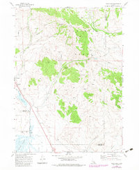
Other maps of this area

1915 · Preston
USGS Topo · 1:96,000

1918 · Preston
USGS Topo · 1:125,000

1954 · Pocatello
USGS Topo · 1:250,000

1955 · Preston
USGS Topo · 1:250,000

1958 · Pocatello
USGS Topo · 1:250,000

1958 · Preston
USGS Topo · 1:250,000

1962 · Preston
USGS Topo · 1:250,000

1968 · Oxford
USGS Topo · 1:24,000

1968 · Clifton
USGS Topo · 1:24,000
1968 · Downey East
USGS Topo · 1:24,000