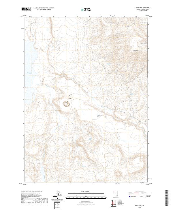
2021 Map of Swan Lake
USGS Topo · Published 2021About this map
Swan Lake Reservoir dominates the western edge of this high-desert landscape in Washoe County, a significant water resource for the surrounding livestock and wildlife range. The terrain rises sharply to the east toward the summit of Catnip Mtn and the dramatic relief of Catnip Canyon, while the broad, elevated expanse of Fish Creek Table defines the central portion of the sheet.
Find a feature on this map
16 named features on this map. Tap any name to fly to it.
Don’t see what you’re looking for? This feature index may not catch every label — zoom into the map to look around manually.
Map Details
Editions of this 2021 Swan Lake Map
This is the sole edition of this map. No revisions or reprints were ever made.
Other maps of this area

1889 · Long Valley
USGS Topo · 1:250,000

1954 · Vya
USGS Topo · 1:250,000

1958 · Vya
USGS Topo · 1:250,000

1962 · Vya
USGS Topo · 1:250,000

1966 · Catnip Canyon
USGS Topo · 1:24,000

1966 · Bald Mountain
USGS Topo · 1:24,000
1966 · Rye Creek
USGS Topo · 1:24,000

1966 · Swan Lake
USGS Topo · 1:24,000

1966 · Badger Mtn NW
USGS Topo · 1:24,000

1966 · Massacre Lake
USGS Topo · 1:24,000