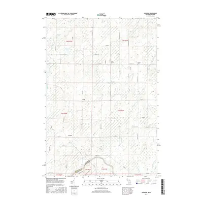
2017 Map of Swanson
USGS Topo · Published 2017About this map
The Menominee River forms the natural boundary between Michigan and Wisconsin at the southern edge of this landscape, where the settlement of Koss sits near the riverbanks. Moving north through the wooded terrain of Marinette County, the map reveals a quiet network of rural communities including Kells, Longrie, and the namesake village of Swanson. This 2017 survey details the drainage patterns of the region, defined by Swanson Cr, Phillips Cr, and the Little Cedar River as they move toward the Menominee. Local heritage is anchored by sites like the Swedish Methodist Cem and the Bethesda Lutheran Cem, which reflect the Scandinavian and Northern European settlement history of this Upper Midwest borderland. Numerous small lakes such as Linnbeek Lake, Ash-Lake, and Johnson Lake dot the northern sections, connected by a grid of numbered roads and family-named tracks like Klippel Ln and Lindgren Ln.
Find a feature on this map
76 named features on this map. Tap any name to fly to it.
Don’t see what you’re looking for? This feature index may not catch every label — zoom into the map to look around manually.
Map Details
Editions of this 2017 Swanson Map
This is the sole edition of this map. No revisions or reprints were ever made.
Other maps of this area

1939 · Pembine
USGS Topo · 1:48,000

1942 · Wausaukee
USGS Topo · 1:48,000

1947 · Pembine
USGS Topo · 1:48,000

1947 · Wausaukee
USGS Topo · 1:48,000

1949 · Stephenson
USGS Topo · 1:48,000

1954 · Escanaba
USGS Topo · 1:250,000

1957 · Escanaba
USGS Topo · 1:250,000

1958 · Escanaba
USGS Topo · 1:250,000

1963 · Pembine
USGS Topo · 1:62,500

1963 · Powers
USGS Topo · 1:62,500