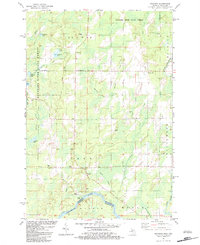
1982 Map of Swanson
USGS Topo · Published 1983About this map
The Menominee River forms the southern boundary of this region, marking the state line between Michigan and Wisconsin. This 1980s landscape is characterized by its numerous small lakes and meandering waterways, including Swanson Lake and the wetlands around Longrie Lake. Small settlements like Swanson, Star Corners, and Kells are linked by a network of local roads and the visible Old Railroad Grade, which speaks to the earlier logging or transport history of the area.
Find a feature on this map
38 named features on this map. Tap any name to fly to it.
Don’t see what you’re looking for? This feature index may not catch every label — zoom into the map to look around manually.
Map Details
Editions of this 1982 Swanson Map
This is the sole edition of this map. No revisions or reprints were ever made.
Other maps of this area

1939 · Pembine
USGS Topo · 1:48,000

1942 · Wausaukee
USGS Topo · 1:48,000

1947 · Pembine
USGS Topo · 1:48,000

1947 · Wausaukee
USGS Topo · 1:48,000

1949 · Stephenson
USGS Topo · 1:48,000

1954 · Escanaba
USGS Topo · 1:250,000

1957 · Escanaba
USGS Topo · 1:250,000

1958 · Escanaba
USGS Topo · 1:250,000

1963 · Pembine
USGS Topo · 1:62,500

1963 · Powers
USGS Topo · 1:62,500