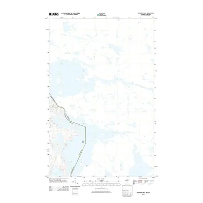
2013 Map of Swansons Bay
USGS Topo · Published 2013About this map
St. Louis Co serves as the backdrop for this border study, where the international boundary between Minnesota and Canada winds through a complex system of interconnected waterways. The aquatic landscape is defined by the expansive reaches of Namakan Lake and Sand Point Lake, which dominate the southern portion of the sheet. This 2013 survey illustrates the intricate shoreline of Burnt Island, a prominent landmass situated at a strategic bend in the international line. The geography here is typical of the northern borderlands, where political boundaries are dictated by the natural contours of deep lakes and narrow channels rather than straight lines, reflecting the historical importance of these water routes for transit and trade between the two nations.
Find a feature on this map
6 named features on this map. Tap any name to fly to it.
Don’t see what you’re looking for? This feature index may not catch every label — zoom into the map to look around manually.
Map Details
Editions of this 2013 Swansons Bay Map
This is the sole edition of this map. No revisions or reprints were ever made.
Other maps of this area

1954 · International Falls
USGS Topo · 1:250,000

1957 · International Falls
USGS Topo · 1:250,000

1958 · International Falls
USGS Topo · 1:250,000

1963 · Snow Bay
USGS Topo · 1:24,000

1963 · Redhorse Bay
USGS Topo · 1:24,000

1963 · Crane Lake
USGS Topo · 1:24,000

1967 · Hale Bay
USGS Topo · 1:24,000

1967 · Johnson Lake
USGS Topo · 1:24,000
1978 · Brule Narrows
USGS Topo · 1:100,000
1978 · Crane Lake
USGS Topo · 1:100,000