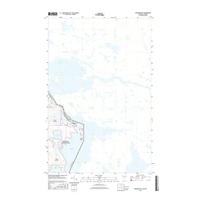
2016 Map of Swansons Bay
USGS Topo · Published 2016About this map
The international boundary between Minnesota and Canada cuts directly through the aquatic landscape of Voyageurs National Park in this 2016 survey. This borderland is defined by a complex network of interconnected waterways, where Namakan Lake and Sand Point Lake meet at the narrow passages of the Namakan Narrows. The terrain is characterized by intricate shorelines and isolated landmasses such as Burnt Island, reflecting the preservation of a wild water-based ecosystem. Significant inlets like Swansons Bay and Grassy Bay illustrate the rugged geography of St. Louis County, providing a clear look at the navigational challenges and natural boundaries that have shaped the transit history of the Rainy River District for generations.
Find a feature on this map
13 named features on this map. Tap any name to fly to it.
Don’t see what you’re looking for? This feature index may not catch every label — zoom into the map to look around manually.
Map Details
Editions of this 2016 Swansons Bay Map
This is the sole edition of this map. No revisions or reprints were ever made.
Other maps of this area

1954 · International Falls
USGS Topo · 1:250,000

1957 · International Falls
USGS Topo · 1:250,000

1958 · International Falls
USGS Topo · 1:250,000

1963 · Snow Bay
USGS Topo · 1:24,000

1963 · Redhorse Bay
USGS Topo · 1:24,000

1963 · Crane Lake
USGS Topo · 1:24,000

1967 · Hale Bay
USGS Topo · 1:24,000

1967 · Johnson Lake
USGS Topo · 1:24,000
1978 · Brule Narrows
USGS Topo · 1:100,000
1978 · Crane Lake
USGS Topo · 1:100,000