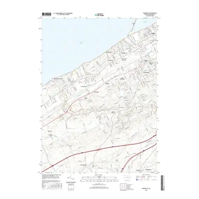
2016 Map of Swanville
USGS Topo · Published 2016About this map
Lake Erie defines the northern reaches of this landscape, with the peninsula of Presque Isle framing Presque Isle Bay at the edge of the Erie urban center. The transition from industrial lakefront and the Erie International Airport to the suburban and rural hinterland is well-documented. Inland, the terrain is carved by Walnut Creek and Elk Creek, which flow through a series of small, long-established communities like Swanville, Fairview, and McKean. For the local historian, the map preserves the locations of numerous memorial sites, including Gate of Heaven Cem and Laurel Hill Cem, alongside early civic markers like the Weis Library. The southern portion of the sheet reveals a more agricultural character near Middleboro, where the road network follows the natural contours of the Bear Run and Brandy Run drainage basins.
Find a feature on this map
232 named features on this map. Tap any name to fly to it.
Don’t see what you’re looking for? This feature index may not catch every label — zoom into the map to look around manually.
Map Details
Editions of this 2016 Swanville Map
This is the sole edition of this map. No revisions or reprints were ever made.
Other maps of this area

1899 · Erie
USGS Topo · 1:62,500

1900 · Girard
USGS Topo · 1:62,500

1900 · Erie
USGS Topo · 1:62,500

1900 · Fairview
USGS Topo · 1:62,500

1923 · Cambridge Springs
USGS Topo · 1:62,500

1925 · Cambridge Springs
USGS Topo · 1:62,500

1943 · Cambridge Springs
USGS Topo · 1:62,500

1950 · Cleveland
USGS Topo · 1:250,000

1950 · Erie
USGS Topo · 1:250,000

1956 · Cleveland
USGS Topo · 1:250,000