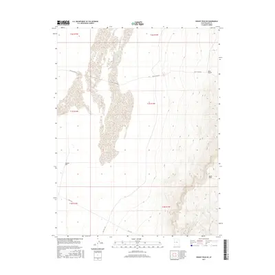
2017 Map of Swasey Peak SW
USGS Topo · Published 2017About this map
Smelter Hills rises above the arid basin in this western Millard County landscape, representing a remote corridor defined by stark topographic shifts. The eastern edge of the quadrangle is dominated by the steep elevations of the Middle Range, which creates a dramatic vertical contrast to the flatter desert valley floor to the west. This area is characterized by a sparse transportation network, primarily consisting of unpaved routes such as Death Canyon Rd and Tule Valley Rd, which follow the natural contours of the desert terrain. The presence of Dome Canyon in the northeast suggests historical passages through these limestone peaks, while the path of Old 6 & 50 in the southwest reflects the evolution of transcontinental travel routes across the Great Basin.
Find a feature on this map
12 named features on this map. Tap any name to fly to it.
Don’t see what you’re looking for? This feature index may not catch every label — zoom into the map to look around manually.
Map Details
Editions of this 2017 Swasey Peak SW Map
This is the sole edition of this map. No revisions or reprints were ever made.
Other maps of this area

1908 · Fish Springs
USGS Topo · 1:250,000

1910 · Fish Springs
USGS Topo · 1:250,000

1953 · Delta
USGS Topo · 1:250,000

1958 · Delta
USGS Topo · 1:250,000

1959 · Cowboy Pass
USGS Topo · 1:62,500

1960 · Notch Peak
USGS Topo · 1:62,500

1960 · Conger Mountain
USGS Topo · 1:62,500

1962 · Delta
USGS Topo · 1:250,000

1972 · Swasey Peak SW
USGS Topo · 1:24,000
1972 · Swasey Peak
USGS Topo · 1:24,000