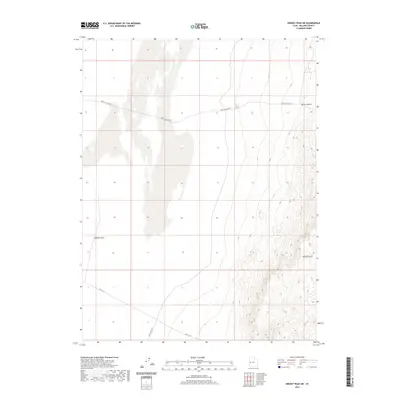
2020 Map of Swasey Peak SW
USGS Topo · Published 2020About this map
Smelter Hills rises above the arid basin of Millard County, providing a stark geographic landmark in this high desert landscape. The terrain is defined by dramatic elevation shifts, moving from the open valley floor to the prominent ridgelines of the Middle Range and the tucked-away corridor of Dome Canyon. Transport through this remote section of the Great Basin is facilitated by a few primary arteries, including the historically named Old 6 & 50 and Tule Valley Rd. The presence of the Death Canyon Rd further underscores the challenging nature of the local geography. This survey provides an essential view of the topographical transitions between the valley and the surrounding peaks, capturing the essential pathways used for exploration and resource management in the region.
Find a feature on this map
6 named features on this map. Tap any name to fly to it.
Don’t see what you’re looking for? This feature index may not catch every label — zoom into the map to look around manually.
Map Details
Editions of this 2020 Swasey Peak SW Map
This is the sole edition of this map. No revisions or reprints were ever made.
Other maps of this area

1908 · Fish Springs
USGS Topo · 1:250,000

1910 · Fish Springs
USGS Topo · 1:250,000

1953 · Delta
USGS Topo · 1:250,000

1958 · Delta
USGS Topo · 1:250,000

1959 · Cowboy Pass
USGS Topo · 1:62,500

1960 · Notch Peak
USGS Topo · 1:62,500

1960 · Conger Mountain
USGS Topo · 1:62,500

1962 · Delta
USGS Topo · 1:250,000

1972 · Swasey Peak SW
USGS Topo · 1:24,000
1972 · Swasey Peak
USGS Topo · 1:24,000