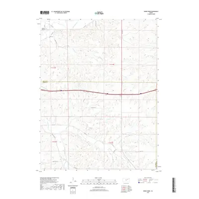
2018 Map of Swede Creek
USGS Topo · Published 2018About this map
McDowell Creek and its many tributaries, including E McDowell Cr and W McDowell Cr, carve through the Flint Hills landscape south of the Kansas River. This 2018 survey illustrates the rural character of the borderlands between Riley, Geary, and Wabaunsee Counties, where large ranching tracts are connected by historic routes like Old Hwy 18 and Lower McDowell Rd. The settlement of Ashland Bottoms and the nearby Ashland Cem stand near the northwestern corner, while the Briggs Cem is located further south along Old Hwy 13. The mapping of Konza Prairie Ln indicates the proximity to protected tallgrass prairie research areas. This hydrological network, featuring numerous named branches such as Pressee Br and Thierer Br, suggests a landscape defined by seasonal water flow and rugged drainage patterns typical of the region.
Find a feature on this map
36 named features on this map. Tap any name to fly to it.
Don’t see what you’re looking for? This feature index may not catch every label — zoom into the map to look around manually.
Map Details
Editions of this 2018 Swede Creek Map
This is the sole edition of this map. No revisions or reprints were ever made.
Other maps of this area

1885 · Eskridge
USGS Topo · 1:125,000

1886 · Junction City
USGS Topo · 1:125,000

1889 · Wamego
USGS Topo · 1:125,000

1889 · Junction City
USGS Topo · 1:125,000

1889 · Parkerville
USGS Topo · 1:125,000

1889 · Eskridge
USGS Topo · 1:125,000

1894 · Eskridge
USGS Topo · 1:125,000

1894 · Junction City
USGS Topo · 1:125,000

1894 · Parkerville
USGS Topo · 1:125,000

1894 · Wamego
USGS Topo · 1:125,000