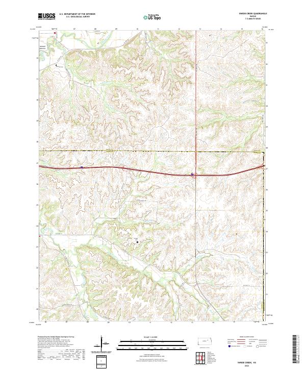
2022 Map of Swede Creek
USGS Topo · Published 2022About this map
Ashland Bottoms and the complex drainage system of McDowell Creek define this landscape along the border of Riley and Geary counties. The terrain is characterized by a network of creek branches, including N Br Kings Cr and S Br Kings Cr, which carve through the Flint Hills region. Settlement patterns remain rural, centered around ranch roads and family-named landmarks like the Ashland Cem in the northwest and Briggs Cem near Swede Cr.
Find a feature on this map
39 named features on this map. Tap any name to fly to it.
Don’t see what you’re looking for? This feature index may not catch every label — zoom into the map to look around manually.
Map Details
Editions of this 2022 Swede Creek Map
This is the sole edition of this map. No revisions or reprints were ever made.
Other maps of this area

1885 · Eskridge
USGS Topo · 1:125,000

1886 · Junction City
USGS Topo · 1:125,000

1889 · Wamego
USGS Topo · 1:125,000

1889 · Junction City
USGS Topo · 1:125,000

1889 · Parkerville
USGS Topo · 1:125,000

1889 · Eskridge
USGS Topo · 1:125,000

1894 · Eskridge
USGS Topo · 1:125,000

1894 · Junction City
USGS Topo · 1:125,000

1894 · Parkerville
USGS Topo · 1:125,000

1894 · Wamego
USGS Topo · 1:125,000