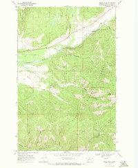
1968 Map of Swede Gulch
USGS Topo · Published 1971About this map
Mining operations and narrow gulches define this 1968 landscape within the Helena National Forest. The northern section is dominated by the Blackfoot River and its confluence with the Landers Fork, while the southern high ground around Crater Mountain is punctuated by significant mineral workings. Evidence of the area's resource-driven history is visible in the cluster of claims such as the Silver Bell Mine, Swansea Mine, and the Last Chance Mine near Davis Gulch.
Find a feature on this map
29 named features on this map. Tap any name to fly to it.
Don’t see what you’re looking for? This feature index may not catch every label — zoom into the map to look around manually.
Map Details
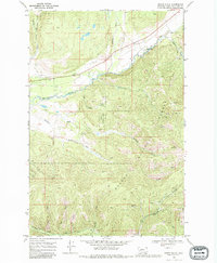
Editions of this 1968 Swede Gulch Map
2 editions found
Other maps of this area

1889 · Helena
USGS Topo · 1:250,000

1893 · Helena
USGS Topo · 1:250,000

1899 · Helena
USGS Topo · 1:250,000

1903 · Coopers Lake
USGS Topo · 1:125,000

1903 · Helena
USGS Topo · 1:250,000

1943 · Hogan
USGS Topo · 1:125,000

1947 · Butte
USGS Topo · 1:250,000

1955 · Choteau
USGS Topo · 1:250,000

1957 · Choteau
USGS Topo · 1:250,000

1958 · Butte
USGS Topo · 1:250,000