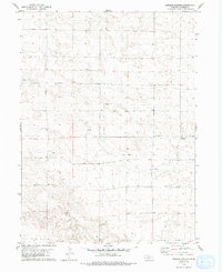
1979 Map of Swedish Cemetery
USGS Topo · Published 1993About this map
The Swedish Cem anchors the northern portion of this Nebraska landscape, providing a primary point of reference for genealogists and local historians studying Cheyenne County. The terrain is defined by the extraction economy of the late 1970s, with a widespread Oil Field and numerous Oil Wells peppered across the sections. The map reveals the systematic development of the plains, where isolated industrial sites like a Gravel Pit and scattered Oil Well locations sit amidst the open township and range grid. This record of human activity illustrates how energy exploration and rural settlement patterns intersected in the High Plains during this era.
Find a feature on this map
6 named features on this map. Tap any name to fly to it.
Don’t see what you’re looking for? This feature index may not catch every label — zoom into the map to look around manually.
Map Details
Editions of this 1979 Swedish Cemetery Map
2 editions found
Other maps of this area

1954 · Scottsbluff
USGS Topo · 1:250,000

1958 · Scottsbluff
USGS Topo · 1:250,000

1972 · Mud Springs SW
USGS Topo · 1:24,000

1972 · Dix
USGS Topo · 1:24,000

1972 · Point Of Rocks
USGS Topo · 1:24,000

1972 · Horsehead Ranch
USGS Topo · 1:24,000

1972 · Potter
USGS Topo · 1:24,000

1973 · Potter 2 SW
USGS Topo · 1:24,000

1973 · Potter 2 SE
USGS Topo · 1:24,000

1973 · Potter 2 NW
USGS Topo · 1:24,000