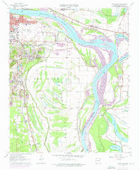
1961 Map of Sweet Home
USGS Topo · Published 1976About this map
Arkansas River navigation and industrial expansion define this Pulaski County landscape during the mid-1970s. The major transportation hubs of Little Rock and North Little Rock converge here, anchored by the Adams Field Municipal Airport and the development of the Little Rock Port. The geography is shaped by the wide loops of the river, where the David D Terry Lock and Dam controls the flow near Steele Bend.
Find a feature on this map
49 named features on this map. Tap any name to fly to it.
Don’t see what you’re looking for? This feature index may not catch every label — zoom into the map to look around manually.
Map Details
Editions of this 1961 Sweet Home Map
4 editions found
Other maps of this area

1891 · Little Rock
USGS Topo · 1:125,000

1893 · Little Rock
USGS Topo · 1:125,000

1935 · Mc Almont
USGS Topo · 1:24,000

1935 · Little Rock
USGS Topo · 1:24,000

1935 · Sweet Home
USGS Topo · 1:24,000

1935 · North Little Rock
USGS Topo · 1:24,000

1935 · Alexander
USGS Topo · 1:48,000

1939 · Keo
USGS Topo · 1:31,680

1940 · Woodson
USGS Topo · 1:31,680

1941 · Alexander
USGS Topo · 1:62,500