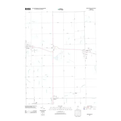
2013 Map of Sweetser
USGS Topo · Published 2013About this map
Sweetser and Swayzee anchor this portion of Grant County, Indiana, where a complex network of man-made waterways like Zirkle Ditch and Grant Howard Ditch demonstrates the intensive agricultural engineering of the region. The landscape is dotted with several small settlements, including Mier, Herbst, and Sims, each connected by a rigid grid of rural roads and the diagonal passage of State Road 18. Natural drainage is primarily handled by Pipe Cr and Taylor Cr, which wind through the flat farmland. This map provides a detailed look at the local infrastructure during the early 21st century, showing how modern residential streets in towns like Converse integrate with the longstanding drainage systems that define the surrounding prairie.
Find a feature on this map
77 named features on this map. Tap any name to fly to it.
Don’t see what you’re looking for? This feature index may not catch every label — zoom into the map to look around manually.
Map Details
Editions of this 2013 Sweetser Map
This is the sole edition of this map. No revisions or reprints were ever made.
Other maps of this area

1953 · La Fontaine
USGS Topo · 1:24,000

1953 · Somerset
USGS Topo · 1:24,000

1953 · Peoria
USGS Topo · 1:24,000

1953 · Muncie
USGS Topo · 1:250,000

1956 · Muncie
USGS Topo · 1:250,000

1960 · Point Isabel
USGS Topo · 1:24,000

1960 · Fairmount
USGS Topo · 1:24,000

1960 · Greentown
USGS Topo · 1:24,000

1961 · Marion
USGS Topo · 1:24,000
1962 · Amboy
USGS Topo · 1:24,000