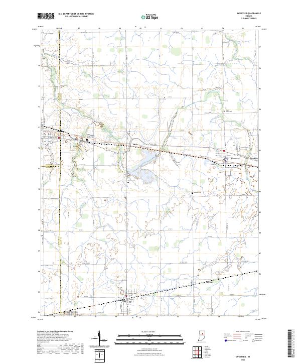
2022 Map of Sweetser
USGS Topo · Published 2022About this map
Agricultural patterns and a dense network of drainage ditches characterize this section of Grant and Miami counties. The landscape is organized around small crossroads settlements and the established towns of Converse and Sweetser. The reliance on water management is evident through numerous named waterways such as Zirkle Ditch, Potter Ditch, and Rich Ditch, which crisscross the till plain to support the region's productive farmland. Historic burial sites are frequent landmarks, including the Independent Order of Odd Fellows Cem and Thraikill Cem. Transportation relies on the historic Delphi Pike and Mier Rd, which connect the local population centers of Mier, Herbst, and Swayzee. The map provides a clear look at the late modern rural infrastructure, where local roads like Co Rd 500 N and W 400 N form a rigid grid over the natural flow of Pipe Cr and Taylor Cr.
Find a feature on this map
68 named features on this map. Tap any name to fly to it.
Don’t see what you’re looking for? This feature index may not catch every label — zoom into the map to look around manually.
Map Details
Editions of this 2022 Sweetser Map
This is the sole edition of this map. No revisions or reprints were ever made.
Other maps of this area

1953 · La Fontaine
USGS Topo · 1:24,000

1953 · Somerset
USGS Topo · 1:24,000

1953 · Peoria
USGS Topo · 1:24,000

1953 · Muncie
USGS Topo · 1:250,000

1956 · Muncie
USGS Topo · 1:250,000

1960 · Point Isabel
USGS Topo · 1:24,000

1960 · Fairmount
USGS Topo · 1:24,000

1960 · Greentown
USGS Topo · 1:24,000

1961 · Marion
USGS Topo · 1:24,000
1962 · Amboy
USGS Topo · 1:24,000