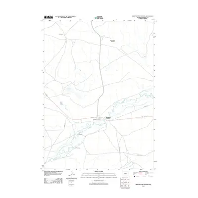
2012 Map of Sweetwater Station
USGS Topo · Published 2012About this map
The Sweetwater River winds through this Central Wyoming landscape, marking a historical corridor defined by long-established trails and ranching operations. The map details the crossing point at Sweetwater Crossing and the nearby Sweetwater Station, sites deeply connected to the western migration era. Traces of the historic Oregon Trl remain visible, cutting across the terrain toward the river.
Find a feature on this map
20 named features on this map. Tap any name to fly to it.
Don’t see what you’re looking for? This feature index may not catch every label — zoom into the map to look around manually.
Map Details
Editions of this 2012 Sweetwater Station Map
This is the sole edition of this map. No revisions or reprints were ever made.
Other maps of this area

1951 · Soap Holes
USGS Topo · 1:24,000

1951 · Myers Ranch
USGS Topo · 1:24,000

1953 · Barras Springs
USGS Topo · 1:24,000

1953 · Sweetwater Station
USGS Topo · 1:24,000

1953 · Happy Spring
USGS Topo · 1:24,000

1953 · Elkhorn Springs
USGS Topo · 1:24,000

1953 · Dishpan Butte
USGS Topo · 1:24,000

1953 · Yellowstone Ranch
USGS Topo · 1:24,000

1953 · Red Canyon
USGS Topo · 1:24,000

1955 · Lander
USGS Topo · 1:250,000