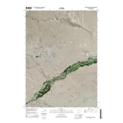
2015 Map of Sweetwater Station
USGS Topo · Published 2015About this map
Sweetwater River meanders across this high plains landscape of Fremont County, anchoring a terrain defined by irrigation systems and historic transit points. Sweetwater Station and Sweetwater Crossing mark central nodes where local roads like Sand Draw Rd and Graham Rd intersect the river valley. The landscape is shaped by human efforts to manage water in an arid environment, evidenced by the National Ditch, Miller Ditch, and the numbered segments of the Graham and Farmsley Ditch Number 1. These features, alongside Carmody Lake, suggest a pastoral economy reliant on diverting the mountain runoff that feeds Warm Springs Cr. Away from the water, the topography rises toward Government Meadows and the indentations of Rocky Draw, providing a detailed look at the township and range grid system in the American West.
Find a feature on this map
25 named features on this map. Tap any name to fly to it.
Don’t see what you’re looking for? This feature index may not catch every label — zoom into the map to look around manually.
Map Details
Editions of this 2015 Sweetwater Station Map
This is the sole edition of this map. No revisions or reprints were ever made.
Other maps of this area

1951 · Soap Holes
USGS Topo · 1:24,000

1951 · Myers Ranch
USGS Topo · 1:24,000

1953 · Barras Springs
USGS Topo · 1:24,000

1953 · Sweetwater Station
USGS Topo · 1:24,000

1953 · Happy Spring
USGS Topo · 1:24,000

1953 · Elkhorn Springs
USGS Topo · 1:24,000

1953 · Dishpan Butte
USGS Topo · 1:24,000

1953 · Yellowstone Ranch
USGS Topo · 1:24,000

1953 · Red Canyon
USGS Topo · 1:24,000

1955 · Lander
USGS Topo · 1:250,000