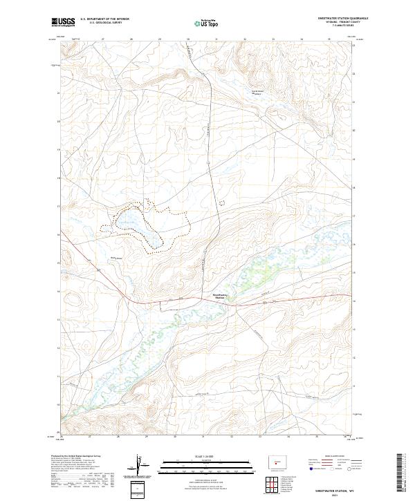
2021 Map of Sweetwater Station
USGS Topo · Published 2021About this map
Sweetwater Station serves as the focal point of this high-desert landscape in Fremont County, where the historic path of the Oregon Trl cuts across the southwestern corner. The map captures a complex system of water management essential to this arid environment, featuring numerous irrigation works such as the Graham and Farmsley Ditch Number 1, Graham and Farmsley Ditch Number 2, and the National Ditch. These channels draw from the Sweetwater River, which meanders through a wide basin floor characterized by wetlands and seasonal drainages.
Find a feature on this map
24 named features on this map. Tap any name to fly to it.
Don’t see what you’re looking for? This feature index may not catch every label — zoom into the map to look around manually.
Map Details
Editions of this 2021 Sweetwater Station Map
This is the sole edition of this map. No revisions or reprints were ever made.
Other maps of this area

1951 · Soap Holes
USGS Topo · 1:24,000

1951 · Myers Ranch
USGS Topo · 1:24,000

1953 · Barras Springs
USGS Topo · 1:24,000

1953 · Sweetwater Station
USGS Topo · 1:24,000

1953 · Happy Spring
USGS Topo · 1:24,000

1953 · Elkhorn Springs
USGS Topo · 1:24,000

1953 · Dishpan Butte
USGS Topo · 1:24,000

1953 · Yellowstone Ranch
USGS Topo · 1:24,000

1953 · Red Canyon
USGS Topo · 1:24,000

1955 · Lander
USGS Topo · 1:250,000