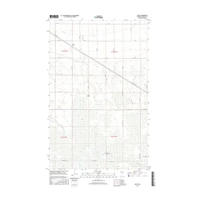
2016 Map of Swift
USGS Topo · Published 2016About this map
Swift sits along the northern edge of this Roseau County landscape, a small community defined by its proximity to the vast wetland terrain of Northern Minnesota. The area is heavily intersected by a network of forest and county roads, including Tangnes Forest RD and Roosevelt Forest RD, which navigate through the predominantly marshy geography. The E Br Warroad River flows through the southern reaches of the quadrangle, with the Scifres Bridge providing a key crossing point for local traffic. Aviation interests are represented by the Erickson Airport, situated centrally among the drainage patterns. This 2016 survey documents a region where transportation is dictated by the challenging hydrography, showing how local infrastructure like Kirkwood Dr and Co Rd 134 adapts to the surrounding wetlands and river systems.
Find a feature on this map
34 named features on this map. Tap any name to fly to it.
Don’t see what you’re looking for? This feature index may not catch every label — zoom into the map to look around manually.
Map Details
Editions of this 2016 Swift Map
This is the sole edition of this map. No revisions or reprints were ever made.
Other maps of this area

1918 · Winterroad
USGS Topo · 1:62,500

1918 · Roosevelt
USGS Topo · 1:62,500

1918 · Warroad
USGS Topo · 1:62,500

1943 · Roosevelt
USGS Topo · 1:62,500

1943 · Warroad
USGS Topo · 1:62,500

1954 · Roseau
USGS Topo · 1:250,000

1957 · Roseau
USGS Topo · 1:250,000

1958 · Roseau
USGS Topo · 1:250,000

1967 · Roosevelt NW
USGS Topo · 1:24,000
1967 · Roosevelt
USGS Topo · 1:24,000