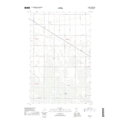
2019 Map of Swift
USGS Topo · Published 2019About this map
Swift sits along the northern edge of this Roseau County landscape, positioned where Kirkwood Dr cuts diagonally across the township lines. The terrain is characterized by the expansive wetlands typical of northern Minnesota, drained in the south by the E Br Warroad River. A network of section-line roads and specialized forest routes, such as Tangnes Forest Rd and Cole Forest Rd, provides access to the dense woodlots and marshes that define the local geography. Human activity is concentrated along these transit corridors, including local aviation at Erickson Airport. Further south, Sciffres Bridge spans the river branch, marking a critical crossing point within the forested interior. The map captures a contemporary look at this rural pocket, where the grid of county roads meets the more organic paths of the state forest lands.
Find a feature on this map
35 named features on this map. Tap any name to fly to it.
Don’t see what you’re looking for? This feature index may not catch every label — zoom into the map to look around manually.
Map Details
Editions of this 2019 Swift Map
This is the sole edition of this map. No revisions or reprints were ever made.
Other maps of this area

1918 · Winterroad
USGS Topo · 1:62,500

1918 · Roosevelt
USGS Topo · 1:62,500

1918 · Warroad
USGS Topo · 1:62,500

1943 · Roosevelt
USGS Topo · 1:62,500

1943 · Warroad
USGS Topo · 1:62,500

1954 · Roseau
USGS Topo · 1:250,000

1957 · Roseau
USGS Topo · 1:250,000

1958 · Roseau
USGS Topo · 1:250,000

1967 · Roosevelt NW
USGS Topo · 1:24,000
1967 · Roosevelt
USGS Topo · 1:24,000