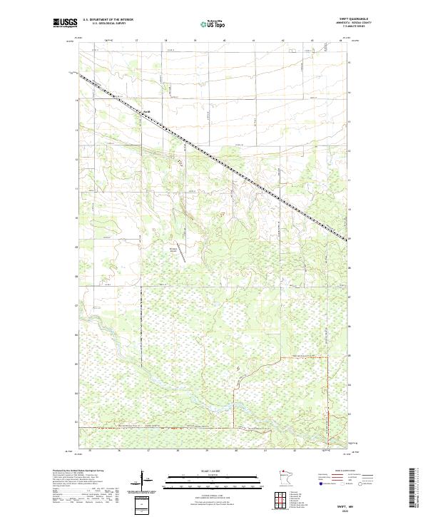
2022 Map of Swift
USGS Topo · Published 2022About this map
The small settlement of Swift anchors the northern portion of this landscape in Roseau County, where the transition from organized farmland to dense wetlands is clearly visible. The terrain is defined by the winding course of the E Br Warroad River, which meanders through the southern half of the sheet. Modern infrastructure is limited but distinct, featuring the Erickson Airport and a network of county roads such as Co Rd 12 and Co Rd 134. The southern reaches of the map show a more remote environment, dominated by the Warroad/Roseau Trails Trl and Tangnes Forest Rd, which cut through the marshy lowland. This region represents a typical northern Minnesota interface between small-scale aviation, scattered rural settlement, and the extensive river-fed wetlands that define the local ecology.
Find a feature on this map
19 named features on this map. Tap any name to fly to it.
Don’t see what you’re looking for? This feature index may not catch every label — zoom into the map to look around manually.
Map Details
Editions of this 2022 Swift Map
This is the sole edition of this map. No revisions or reprints were ever made.
Other maps of this area

1918 · Winterroad
USGS Topo · 1:62,500

1918 · Roosevelt
USGS Topo · 1:62,500

1918 · Warroad
USGS Topo · 1:62,500

1943 · Roosevelt
USGS Topo · 1:62,500

1943 · Warroad
USGS Topo · 1:62,500

1954 · Roseau
USGS Topo · 1:250,000

1957 · Roseau
USGS Topo · 1:250,000

1958 · Roseau
USGS Topo · 1:250,000

1967 · Roosevelt NW
USGS Topo · 1:24,000
1967 · Roosevelt
USGS Topo · 1:24,000