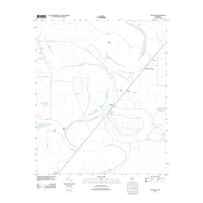
2012 Map of Swiftown
USGS Topo · Published 2012About this map
Swiftown sits at the heart of this Leflore County landscape, where the alluvial plain is defined by a complex network of oxbow lakes and sloughs. The geography here is dominated by the meandering path of Bear Cr, which snakes past Mossy Island and a series of elongated water bodies including Bee Lake and Wasp Lake. These water features, alongside Burns Slough and Oak Bayou, illustrate the persistent hydrologic patterns of the Mississippi Delta.
Find a feature on this map
58 named features on this map. Tap any name to fly to it.
Don’t see what you’re looking for? This feature index may not catch every label — zoom into the map to look around manually.
Map Details
Editions of this 2012 Swiftown Map
This is the sole edition of this map. No revisions or reprints were ever made.
Other maps of this area

1940 · Auter
USGS Topo · 1:62,500

1940 · Baird
USGS Topo · 1:62,500

1940 · Mileston
USGS Topo · 1:62,500

1953 · Greenwood
USGS Topo · 1:250,000

1954 · Mileston
USGS Topo · 1:62,500

1956 · Greenwood
USGS Topo · 1:250,000

1961 · Mossy Lake
USGS Topo · 1:62,500

1965 · Inverness
USGS Topo · 1:24,000
1965 · Bellewood
USGS Topo · 1:24,000

1967 · Baird
USGS Topo · 1:62,500