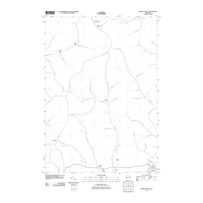
2010 Map of Swinns Valley
USGS Topo · Published 2010About this map
Montana Ridge and a series of deeply carved tributary valleys define the topography north of the Trempealeau River in this Trempealeau County landscape. The settlement of Arcadia sits at the base of American Valley, where the river corridor facilitates transportation and agricultural commerce. The uplands are marked by distinct topographic features named for local families and settlers, including Riecks Valley, Dascher Valley, and Nicolai Valley.
Find a feature on this map
43 named features on this map. Tap any name to fly to it.
Don’t see what you’re looking for? This feature index may not catch every label — zoom into the map to look around manually.
Map Details
Editions of this 2010 Swinns Valley Map
This is the sole edition of this map. No revisions or reprints were ever made.
Other maps of this area

1926 · Whitehall
USGS Topo · 1:62,500

1929 · Whitehall
USGS Topo · 1:62,500

1929 · Fountain City
USGS Topo · 1:62,500

1929 · Galesville
USGS Topo · 1:62,500

1932 · Gilmanton
USGS Topo · 1:62,500

1934 · Winona
USGS Topo · 1:62,500

1937 · Winona
USGS Topo · 1:62,500

1953 · Eau Claire
USGS Topo · 1:250,000

1958 · Eau Claire
USGS Topo · 1:250,000

1964 · Eau Claire
USGS Topo · 1:250,000