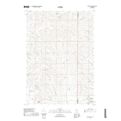
2018 Map of Swinns Valley
USGS Topo · Published 2018About this map
Arcadia sits at the base of a complex series of ridges and coulees in Buffalo and Trempealeau Counties, where the Trempealeau River flows through the southeastern corner of the landscape. The terrain is defined by its deep drainage patterns, with the high ground of Montana Ridge and Fountain City Ridge overlooking narrow, family-named valleys like Swinns Valley and Botana Valley. These corridors have long shaped the local geography, with roads such as Boland Valley Rd and Ziegeweid Valley Rd following the natural contours of the land. For genealogists, the map preserves the location of the Lower Montana Ridge Cem on the northern uplands. The distribution of named features like Riecks Valley and Joos Valley reflects the region's history of valley-bottom agricultural settlement beneath the steep bluffs of Glencoe Ridge.
Find a feature on this map
67 named features on this map. Tap any name to fly to it.
Don’t see what you’re looking for? This feature index may not catch every label — zoom into the map to look around manually.
Map Details
Editions of this 2018 Swinns Valley Map
This is the sole edition of this map. No revisions or reprints were ever made.
Other maps of this area

1926 · Whitehall
USGS Topo · 1:62,500

1929 · Whitehall
USGS Topo · 1:62,500

1929 · Fountain City
USGS Topo · 1:62,500

1929 · Galesville
USGS Topo · 1:62,500

1932 · Gilmanton
USGS Topo · 1:62,500

1934 · Winona
USGS Topo · 1:62,500

1937 · Winona
USGS Topo · 1:62,500

1953 · Eau Claire
USGS Topo · 1:250,000

1958 · Eau Claire
USGS Topo · 1:250,000

1964 · Eau Claire
USGS Topo · 1:250,000