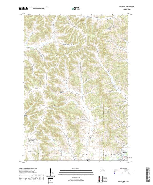
2022 Map of Swinns Valley
USGS Topo · Published 2022About this map
Montana Ridge defines the northern reaches of this landscape, serving as a high divide between numerous deeply incised drainages. The area is characterized by a dense network of coulees and valleys, including Swinns Valley, Boland Valley, and Lewis Valley, which illustrate the complex topography of the Driftless Area. Human activity follows these natural corridors, with many roads like Montana Ridge Rd and Boland Valley Rd tracing the ridges and valley floors. The city of Arcadia appears in the southeast corner along the Trempealeau River, representing the primary population center. For genealogists and local historians, the map identifies specific landmarks such as the Lower Montana Ridge Cem and Glencoe Cem, providing precise locations for these community sites. Ridges like Glencoe Ridge and Fountain City Ridge frame the southern landscape, while the Buffalo and Trempealeau county line bisects the eastern portion of the sheet.
Find a feature on this map
68 named features on this map. Tap any name to fly to it.
Don’t see what you’re looking for? This feature index may not catch every label — zoom into the map to look around manually.
Map Details
Editions of this 2022 Swinns Valley Map
This is the sole edition of this map. No revisions or reprints were ever made.
Other maps of this area

1926 · Whitehall
USGS Topo · 1:62,500

1929 · Whitehall
USGS Topo · 1:62,500

1929 · Fountain City
USGS Topo · 1:62,500

1929 · Galesville
USGS Topo · 1:62,500

1932 · Gilmanton
USGS Topo · 1:62,500

1934 · Winona
USGS Topo · 1:62,500

1937 · Winona
USGS Topo · 1:62,500

1953 · Eau Claire
USGS Topo · 1:250,000

1958 · Eau Claire
USGS Topo · 1:250,000

1964 · Eau Claire
USGS Topo · 1:250,000