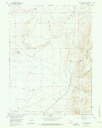
1955 Map of Sybille Springs
USGS Topo · Published 1976About this map
Sybille Springs and the eastern slopes of the Laramie Mountains define this high-altitude cattle country. Mapped in the mid-1950s for the Missouri River Basin development program, the landscape is marked by a network of seasonal drainages and springs vital to local ranching operations like the Farley Ranch and Radichle Ranch. The terrain is characterized by prominent flat-topped mesas and ridges, including Flat Top and Pine Ridge, which overlook the winding course of North Sybille Creek and Plumbago Creek.
Find a feature on this map
22 named features on this map. Tap any name to fly to it.
Don’t see what you’re looking for? This feature index may not catch every label — zoom into the map to look around manually.
Map Details
Editions of this 1955 Sybille Springs Map
3 editions found
Other maps of this area

1954 · Cheyenne
USGS Topo · 1:250,000

1955 · Bosler
USGS Topo · 1:24,000

1955 · Bosler SE
USGS Topo · 1:24,000

1955 · Mc Gill Lakes
USGS Topo · 1:24,000

1955 · Bluegrass Wells
USGS Topo · 1:24,000

1955 · Sybille Springs
USGS Topo · 1:24,000

1955 · Lake Ione
USGS Topo · 1:24,000

1955 · Guide Rock
USGS Topo · 1:24,000

1955 · Baldy Mountain
USGS Topo · 1:24,000

1955 · Sheep Rock
USGS Topo · 1:24,000