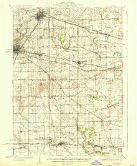
1937 Map of Sycamore
USGS Topo · Published 1937About this map
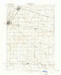
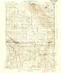
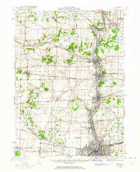
Sycamore and DeKalb serve as the primary hubs in this late-1930s landscape, which is heavily defined by an intricate network of drainage systems and railroads. The agricultural character of the region is evident in the dense distribution of one-room schoolhouses like Mount Hunger Sch, Five Points Sch, and Coltonville Sch, marking the intersections of rural life. The Chicago and Northwestern and the Chicago Great Western railroads cut across the terrain, facilitating the movement of goods between small prairie settlements like Cortland, Maple Park, and Richardson.
Find a feature on this map
79 named features on this map. Tap any name to fly to it.
Don’t see what you’re looking for? This feature index may not catch every label — zoom into the map to look around manually.
Map Details
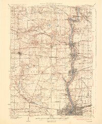
Editions of this 1937 Sycamore Map
2 editions found
Other maps of this area

1918 · Kirkland
USGS Topo · 1:62,500

1925 · Yorkville
USGS Topo · 1:62,500

1925 · Elgin
USGS Topo · 1:62,500
1932 · Geneva
USGS Topo · 1:62,500
1934 · De Kalb
USGS Topo · 1:62,500
1937 · De Kalb
USGS Topo · 1:62,500
1937 · Sycamore
USGS Topo · 1:62,500
1938 · Genoa
USGS Topo · 1:62,500

1940 · Elgin
USGS Topo · 1:62,500
1948 · Geneva
USGS Topo · 1:62,500
Featured Places
- DeKalb, DeKalb Township
- Sycamore, IL
- Sugar Grove, Sugar Grove Township
- Cortland, Cortland Township
- Hinckley, Squaw Grove Township