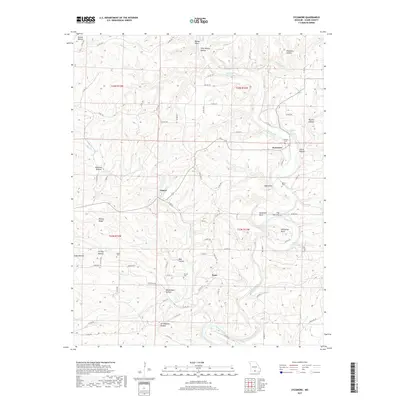
2017 Map of Sycamore
USGS Topo · Published 2017About this map
Bryant Creek dictates the geography of this Ozark County landscape, carving dramatic geological features like The Narrows, Muleshoe Bend, and Horseshoe Bend. The settlement pattern follows the water and the ridges, with Sycamore established near the headwaters of several hollows and Zanoni situated to the west. This 2017 survey details the complex hydrography of the region, including notable water sources like Hodgson Mill Spring and Brixey Spring. Local history and genealogy are preserved through several scattered burial grounds, such as Sanders Cem, Martin Cem, and Patrick Cem. The terrain is characterized by a dense network of hollows, including Owens Hollow, Birdtown Hollow, and Weidensaul Hollow, which define the drainage patterns into the larger creeks. This map provides a contemporary look at these rural communities and the underlying topography that has shaped their development for generations.
Find a feature on this map
80 named features on this map. Tap any name to fly to it.
Don’t see what you’re looking for? This feature index may not catch every label — zoom into the map to look around manually.
Map Details
Editions of this 2017 Sycamore Map
This is the sole edition of this map. No revisions or reprints were ever made.
Other maps of this area

1934 · Gainesville
USGS Topo · 1:48,000

1937 · Buckhart
USGS Topo · 1:48,000

1939 · Topaz
USGS Topo · 1:62,500

1940 · Gainesville
USGS Topo · 1:62,500

1941 · Topaz
USGS Topo · 1:62,500

1943 · Buckhart
USGS Topo · 1:62,500

1944 · Cureall
USGS Topo · 1:62,500

1945 · Harrison
USGS Topo · 1:250,000

1945 · Buckhart
USGS Topo · 1:62,500

1946 · Cureall
USGS Topo · 1:62,500