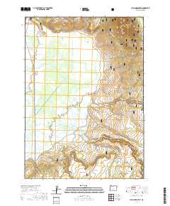
2020 Map of Sycan Marsh East
USGS Topo · Published 2020About this map
Sycan Marsh dominates this high-desert basin within the Fremont National Forest, serving as a critical hydrologic center where Coyote Cr and the Sycan Wild and Scenic River converge. The landscape is defined by the transition from the sprawling wetlands of the marsh to the surrounding uplands, marked by Brattain Ridge and the volcanic prominence of Sycan Butte. This 2020 survey illustrates the complex water network of the Sycan River system, including Chocktoot Cr and its northern fork. Though largely a natural preserve, human activity is noted at the Saxon Sycan Airport on the marsh's western edge and along the isolated Trunk Road. To the south, the topography levels into Sycan Flat, where small water bodies like Louse Lake and Lake Henry pocket the terrain.
Find a feature on this map
19 named features on this map. Tap any name to fly to it.
Don’t see what you’re looking for? This feature index may not catch every label — zoom into the map to look around manually.
Map Details
Editions of this 2020 Sycan Marsh East Map
This is the sole edition of this map. No revisions or reprints were ever made.
Other maps of this area

1889 · Klamath
USGS Topo · 1:250,000

1894 · Klamath
USGS Topo · 1:250,000

1955 · Klamath Falls
USGS Topo · 1:250,000

1958 · Klamath Falls
USGS Topo · 1:250,000

1960 · Riverbed Butte
USGS Topo · 1:62,500

1960 · Sycan Marsh
USGS Topo · 1:62,500

1966 · Shake Butte
USGS Topo · 1:24,000

1966 · Pole Butte
USGS Topo · 1:24,000

1966 · Foster Butte
USGS Topo · 1:24,000

1974 · Lake Abert
USGS Topo · 1:100,000