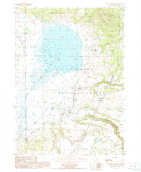
1988 Map of Sycan Marsh East
USGS Topo · Published 1988About this map
Sycan Marsh dominates this landscape, a significant wetland environment in Lake County recorded during the mid-1980s. The map illustrates a high-elevation basin where the Sycan River and Shake Creek converge, feeding into the marshlands before the river continues its course southward. Human presence is marked by the Brattain Ranch and several stock ponds, reflecting the area's long-standing ranching history within the Fremont National Forest.
Find a feature on this map
18 named features on this map. Tap any name to fly to it.
Don’t see what you’re looking for? This feature index may not catch every label — zoom into the map to look around manually.
Map Details
Editions of this 1988 Sycan Marsh East Map
This is the sole edition of this map. No revisions or reprints were ever made.
Other maps of this area

1889 · Klamath
USGS Topo · 1:250,000

1894 · Klamath
USGS Topo · 1:250,000

1955 · Klamath Falls
USGS Topo · 1:250,000

1958 · Klamath Falls
USGS Topo · 1:250,000

1960 · Riverbed Butte
USGS Topo · 1:62,500

1960 · Sycan Marsh
USGS Topo · 1:62,500

1966 · Shake Butte
USGS Topo · 1:24,000

1966 · Pole Butte
USGS Topo · 1:24,000

1966 · Foster Butte
USGS Topo · 1:24,000

1974 · Lake Abert
USGS Topo · 1:100,000