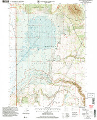
2004 Map of Sycan Marsh East
USGS Topo · Published 2007About this map
Sycan Marsh dominates this landscape within the Fremont National Forest, serving as a critical hydrologic center where the Sycan River and numerous springs converge. This 2004 revision reveals the managed nature of the high desert basin, marked by a weir and several wells that support local ranching operations. To the north, Brattain Ridge rises above the marshy flats, while the Brattain Ranch and a nearby Mobile Home Park indicate the sparse but established human presence in this part of Lake County.
Find a feature on this map
19 named features on this map. Tap any name to fly to it.
Don’t see what you’re looking for? This feature index may not catch every label — zoom into the map to look around manually.
Map Details
Editions of this 2004 Sycan Marsh East Map
This is the sole edition of this map. No revisions or reprints were ever made.
Other maps of this area

1889 · Klamath
USGS Topo · 1:250,000

1894 · Klamath
USGS Topo · 1:250,000

1955 · Klamath Falls
USGS Topo · 1:250,000

1958 · Klamath Falls
USGS Topo · 1:250,000

1960 · Riverbed Butte
USGS Topo · 1:62,500

1960 · Sycan Marsh
USGS Topo · 1:62,500

1966 · Shake Butte
USGS Topo · 1:24,000

1966 · Pole Butte
USGS Topo · 1:24,000

1966 · Foster Butte
USGS Topo · 1:24,000

1974 · Lake Abert
USGS Topo · 1:100,000