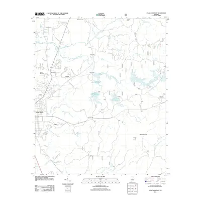
2011 Map of Sylacauga East
USGS Topo · Published 2011About this map
Sylacauga serves as the focal point for this eastern Talladega County survey, where the urban grid gives way to a network of creeks and small settlements. The landscape is defined by the drainage of Tallaseehatchee Creek and its many tributaries, including Emauhee Creek and Crooked Creek. This era of water management is visible through the Tallaseehatchee Creek Watershed N and the presence of Howard Dam, which forms Lake Howard. Local genealogical interests are well-served by the inclusion of multiple burial grounds such as Evergreen Cemetery, Westview Cemetery, and Summer Hill Cemetery. To the north and east, the terrain rises toward Heards Mountain and Rebecca Mountain, separated by natural passages like Heards Gap. Smaller communities like Liberty Hill, Sunrise, and The Moon are linked by rural routes such as Hickman Quarry Rd and Doc Harris Rd, reflecting the scattered residential patterns outside the main town center.
Find a feature on this map
115 named features on this map. Tap any name to fly to it.
Don’t see what you’re looking for? This feature index may not catch every label — zoom into the map to look around manually.
Map Details
Editions of this 2011 Sylacauga East Map
This is the sole edition of this map. No revisions or reprints were ever made.
Other maps of this area

1890 · Talladega
USGS Topo · 1:125,000

1892 · Talladega
USGS Topo · 1:125,000

1915 · Gantts Quarry
USGS Topo · 1:48,000

1917 · Gantts Quarry
USGS Topo · 1:62,500

1943 · Talladega
USGS Topo · 1:62,500

1944 · Goodwater
USGS Topo · 1:62,500

1946 · Talladega
USGS Topo · 1:62,500

1947 · Goodwater
USGS Topo · 1:62,500

1953 · Birmingham
USGS Topo · 1:250,000

1956 · Birmingham
USGS Topo · 1:250,000