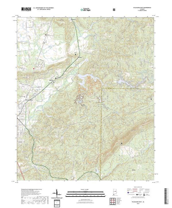
2024 Map of Sylacauga East
USGS Topo · Published 2024About this map
Sylacauga and its eastern surroundings occupy the transition from the city's residential streets into the dense woodlands of the Talladega National Forest. This modern record reveals a landscape where historical burial grounds and rural settlements like Oldfield and Sycamore remain significant landmarks. Significant water features include the impounded Lake Howard and the Tallaseehatchee Cr Watershed, while the eastern terrain is defined by the steep rises of Rebecca Mtn and Herds Mtn. Researchers will find a high density of small family and community cemeteries, such as the Cook Place Cem and Corinth Missionary Church Cem, which serve as genealogical anchors across the rolling topography. The presence of the CSX rail line and Hickman Quarry Rd points to the industrial foundations that have long supported the local economy alongside the timber resources of the national forest.
Find a feature on this map
119 named features on this map. Tap any name to fly to it.
Don’t see what you’re looking for? This feature index may not catch every label — zoom into the map to look around manually.
Map Details
Editions of this 2024 Sylacauga East Map
This is the sole edition of this map. No revisions or reprints were ever made.
Other maps of this area

1890 · Talladega
USGS Topo · 1:125,000

1892 · Talladega
USGS Topo · 1:125,000

1915 · Gantts Quarry
USGS Topo · 1:48,000

1917 · Gantts Quarry
USGS Topo · 1:62,500

1943 · Talladega
USGS Topo · 1:62,500

1944 · Goodwater
USGS Topo · 1:62,500

1946 · Talladega
USGS Topo · 1:62,500

1947 · Goodwater
USGS Topo · 1:62,500

1953 · Birmingham
USGS Topo · 1:250,000

1956 · Birmingham
USGS Topo · 1:250,000