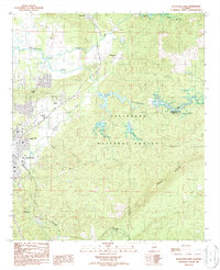
1987 Map of Sylacauga East
USGS Topo · Published 1987About this map
The industrial and rural landscape east of Sylacauga is defined by the transition from city outskirts to the densely forested ridges of the Talladega National Forest. In the late 1980s, the area's economy is clearly tied to its geology and transportation infrastructure, with the CSX and Southern railroads skirting the foothills and serving local industry. A prominent Rock Quarry (Abandoned) located near Oldfield reflects the region's history of mineral extraction, while the Water Filtration Plant at Lake Howard underscores the importance of the local watershed.
Find a feature on this map
30 named features on this map. Tap any name to fly to it.
Don’t see what you’re looking for? This feature index may not catch every label — zoom into the map to look around manually.
Map Details
Editions of this 1987 Sylacauga East Map
This is the sole edition of this map. No revisions or reprints were ever made.
Other maps of this area

1890 · Talladega
USGS Topo · 1:125,000

1892 · Talladega
USGS Topo · 1:125,000

1915 · Gantts Quarry
USGS Topo · 1:48,000

1917 · Gantts Quarry
USGS Topo · 1:62,500

1943 · Talladega
USGS Topo · 1:62,500

1944 · Goodwater
USGS Topo · 1:62,500

1946 · Talladega
USGS Topo · 1:62,500

1947 · Goodwater
USGS Topo · 1:62,500

1953 · Birmingham
USGS Topo · 1:250,000

1956 · Birmingham
USGS Topo · 1:250,000