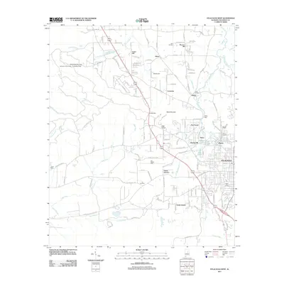
2011 Map of Sylacauga West
USGS Topo · Published 2011About this map
Sylacauga and its industrial western outskirts are defined by the intersection of specialized extraction and transportation networks. The map documents the extensive footprint of Gantts Quarry, a cornerstone of the local marble industry, alongside the community of Gantts Junction. Settlement patterns follow the low ridges and creek valleys, with established neighborhoods like Mignon, Walco, and Oak Grove clustered near the urban core, while more rural hamlets such as Zubers, Marble Hill, and Odena dot the northern landscape.
Find a feature on this map
130 named features on this map. Tap any name to fly to it.
Don’t see what you’re looking for? This feature index may not catch every label — zoom into the map to look around manually.
Map Details
Editions of this 2011 Sylacauga West Map
This is the sole edition of this map. No revisions or reprints were ever made.
Other maps of this area

1890 · Talladega
USGS Topo · 1:125,000

1892 · Talladega
USGS Topo · 1:125,000

1915 · Gantts Quarry
USGS Topo · 1:48,000

1917 · Gantts Quarry
USGS Topo · 1:62,500

1943 · Talladega
USGS Topo · 1:62,500

1944 · Goodwater
USGS Topo · 1:62,500

1946 · Talladega
USGS Topo · 1:62,500

1947 · Goodwater
USGS Topo · 1:62,500

1953 · Birmingham
USGS Topo · 1:250,000

1956 · Birmingham
USGS Topo · 1:250,000