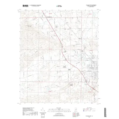
2018 Map of Sylacauga West
USGS Topo · Published 2018About this map
Gantts Quarry anchors the landscape south of the city, a site deeply tied to the industrial identity of this Alabama region. The corridor between Childersburg and Sylacauga reveals a complex network of residential clusters and small communities, including Mignon, Oak Grove, and Zubers. Transportation and commerce are centered around Gantts Junction and the presence of Merkel Field Sylacauga Municipal Airport, which facilitates regional connectivity.
Find a feature on this map
158 named features on this map. Tap any name to fly to it.
Don’t see what you’re looking for? This feature index may not catch every label — zoom into the map to look around manually.
Map Details
Editions of this 2018 Sylacauga West Map
This is the sole edition of this map. No revisions or reprints were ever made.
Other maps of this area

1890 · Talladega
USGS Topo · 1:125,000

1892 · Talladega
USGS Topo · 1:125,000

1915 · Gantts Quarry
USGS Topo · 1:48,000

1917 · Gantts Quarry
USGS Topo · 1:62,500

1943 · Talladega
USGS Topo · 1:62,500

1944 · Goodwater
USGS Topo · 1:62,500

1946 · Talladega
USGS Topo · 1:62,500

1947 · Goodwater
USGS Topo · 1:62,500

1953 · Birmingham
USGS Topo · 1:250,000

1956 · Birmingham
USGS Topo · 1:250,000