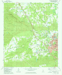
1980 Map of Sylacauga West
USGS Topo · Published 1980About this map
The white marble industry of Talladega County is evident in this 1980 survey, which highlights the industrial and residential development west of the city center. The landscape is anchored by massive operations at Gantts Quarry and several other unlabeled quarries near Marble City Lake, showing the area's deep geological and economic ties to stone extraction. To the north and west, the terrain rises toward Kahatchee Mountain, where the Kahatchee Lookout Tower stands as a sentinel over the surrounding ridges and the waters of Kahatchee Creek.
Find a feature on this map
64 named features on this map. Tap any name to fly to it.
Don’t see what you’re looking for? This feature index may not catch every label — zoom into the map to look around manually.
Map Details
Editions of this 1980 Sylacauga West Map
This is the sole edition of this map. No revisions or reprints were ever made.
Other maps of this area

1890 · Talladega
USGS Topo · 1:125,000

1892 · Talladega
USGS Topo · 1:125,000

1915 · Gantts Quarry
USGS Topo · 1:48,000

1917 · Gantts Quarry
USGS Topo · 1:62,500

1943 · Talladega
USGS Topo · 1:62,500

1944 · Goodwater
USGS Topo · 1:62,500

1946 · Talladega
USGS Topo · 1:62,500

1947 · Goodwater
USGS Topo · 1:62,500

1953 · Birmingham
USGS Topo · 1:250,000

1956 · Birmingham
USGS Topo · 1:250,000