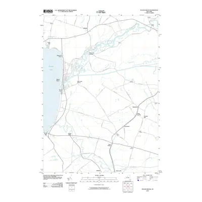
2010 Map of Sylvan Beach
USGS Topo · Published 2010About this map
Oneida Lake anchors the eastern shore where the Fish Creek and Wood Creek systems converge, creating a landscape defined by historic water transport and resort development. The shoreline features the prominent Verona Beach Light, marking the entrance to the canal system for vessels navigating toward the Verona Beach and Sylvan Beach communities. Inland, the map reveals a dense network of early settlements and family-named landmarks including Starks Landing, Higginsville, and Dumbarton. Genealogists will find a significant distribution of burial sites across the township, such as Murray Cemetery, Doxtater Cemetery, and Braddock Cemetery. The transition from the marshy lowlands near Oneida Valley to the rise of Irish Ridge illustrates the geographical constraints that shaped the local agricultural and transportation corridors, including the path of Brandy Brook.
Find a feature on this map
76 named features on this map. Tap any name to fly to it.
Don’t see what you’re looking for? This feature index may not catch every label — zoom into the map to look around manually.
Map Details
Editions of this 2010 Sylvan Beach Map
This is the sole edition of this map. No revisions or reprints were ever made.
Other maps of this area

1895 · Chittenango
USGS Topo · 1:62,500

1895 · Oneida
USGS Topo · 1:62,500

1898 · Oneida
USGS Topo · 1:62,500

1898 · Chittenango
USGS Topo · 1:62,500

1902 · Chittenango
USGS Topo · 1:62,500

1902 · Oneida
USGS Topo · 1:62,500

1905 · Taberg
USGS Topo · 1:62,500

1906 · Kasoag
USGS Topo · 1:62,500

1939 · Oneida
USGS Topo · 1:62,500

1941 · Jewell
USGS Topo · 1:24,000