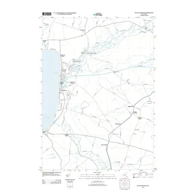
2013 Map of Sylvan Beach
USGS Topo · Published 2013About this map
Oneida Lake defines the western edge of this landscape, where the Erie Canal cuts eastward toward Higginsville. The transition from the lakeshore tourism hubs at Sylvan Beach and Verona Beach—complete with a Beach Light and multiple marinas—gives way to a rural interior shaped by the winding courses of Fish Cr and Wood Cr.
Find a feature on this map
104 named features on this map. Tap any name to fly to it.
Don’t see what you’re looking for? This feature index may not catch every label — zoom into the map to look around manually.
Map Details
Editions of this 2013 Sylvan Beach Map
This is the sole edition of this map. No revisions or reprints were ever made.
Other maps of this area

1895 · Chittenango
USGS Topo · 1:62,500

1895 · Oneida
USGS Topo · 1:62,500

1898 · Oneida
USGS Topo · 1:62,500

1898 · Chittenango
USGS Topo · 1:62,500

1902 · Chittenango
USGS Topo · 1:62,500

1902 · Oneida
USGS Topo · 1:62,500

1905 · Taberg
USGS Topo · 1:62,500

1906 · Kasoag
USGS Topo · 1:62,500

1939 · Oneida
USGS Topo · 1:62,500

1941 · Jewell
USGS Topo · 1:24,000