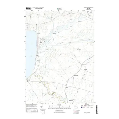
2016 Map of Sylvan Beach
USGS Topo · Published 2016About this map
Oneida Lake defines the western edge of this landscape, where the eastern shore transitions from the sandy reaches of Sylvan Beach and Verona Beach State Park into the intricate wetlands of the Oneida Creek delta. The region's historical reliance on water transport is evident in the path of the Erie Canal, which cuts across the terrain to meet the lake near Fish Creek Station. Further inland, the map shows a network of small settlements such as Vienna, Higginsville, and Durhamville, often situated near prominent watercourses like Fish Creek and Wood Cr.
Find a feature on this map
100 named features on this map. Tap any name to fly to it.
Don’t see what you’re looking for? This feature index may not catch every label — zoom into the map to look around manually.
Map Details
Editions of this 2016 Sylvan Beach Map
This is the sole edition of this map. No revisions or reprints were ever made.
Other maps of this area

1895 · Chittenango
USGS Topo · 1:62,500

1895 · Oneida
USGS Topo · 1:62,500

1898 · Oneida
USGS Topo · 1:62,500

1898 · Chittenango
USGS Topo · 1:62,500

1902 · Chittenango
USGS Topo · 1:62,500

1902 · Oneida
USGS Topo · 1:62,500

1905 · Taberg
USGS Topo · 1:62,500

1906 · Kasoag
USGS Topo · 1:62,500

1939 · Oneida
USGS Topo · 1:62,500

1941 · Jewell
USGS Topo · 1:24,000